Sustainable Framework
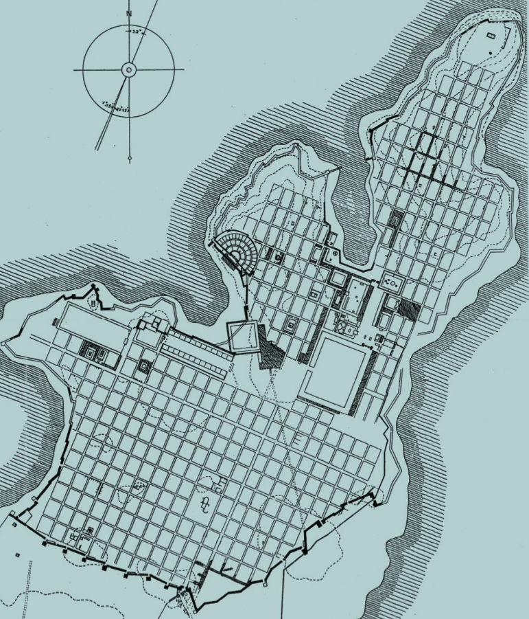
For 2500 years, at least, we have been planning cities that are incredibly sustainable. Since the very first cities were planned (up until November 22, 1926), planned, or designed cities have had one very basic thing in common. They were all planned using a basic framework of public and private spaces. As we see here, Miletus, one of the first planned cities in the world, was done so by simply projecting streets and other public spaces. It did nothing more than describe what is public; streets and squares, major public buildings, and what is private; those areas for building things like houses, shops and offices. This seemed to work pretty well, so we continued making cities like this for quite a long time.
If we skip ahead a couple of millennia, we can see how this works closer to home. In New York in 1807 a small group was commissioned to plan everything north of Houston and 14th Street on the island of Manhattan. What resulted was the Commissioners plan of 1811; this is the plan that would dictate development of the entire island, and it was nothing more than a simple projection of this public framework (or, in other words, streets and parks). The Commissioners, although for different reasons and with a different pattern, did exactly the same thing Hippodamus had done 2500 years earlier on the Aegean Sea.

The result of this framework plan was to allow something that started as undeveloped land, with some random villages and farms to utterly transform over the next two hundred years. This simple mechanism and really nothing else created a framework that could accommodate this fantastic, changing city.

It allowed the bucolic landscape of the early 19th century to turn into a very different city over the next two centuries.

And the magic of the plan is that it allowed (not required, but allowed; a major distinction) all of this to happen.

It created an incredibly sustainable system that allowed this, in 1865 a small farmhouse at the intersection of 33rd and Lexington, to turn into the same intersection that we know today, very different in use and program, but exactly the same in terms of rights-of-way and development area. By laying out permanent, public streets in the original plan, all of the things that we use as a community; water, sewer, power, the subway, could be put in a place that would never change, while the individual buildings, a wood house, or a giant high-rise, could, and can, come and go as they please, simply plugging into the public system. This is sort of the original plug and play 200 years ago, or really, even 2500 years ago.

We can see this in cities all over the country, and all over the world from Savannah to Philadelphia, and beyond. But for some reason it is hard for us to imagine doing this again, putting in a framework of streets and public spaces, in the absence of uses. Why? More on that later.